Log in
All resources
Create a design
2,977 Free Artworks of City Map
bibliothèque nationale de france
baroque
atlas map
david rumsey historical map collection
maps of paris from the david rumsey historical map collection
matthäus merian
maps in the library of congress
maps by willem and johannes blaeu
copper engraving print
drawing
old submaps of paris
philippe buache
map of maastricht by willem and johannes blaeu (1649)
jezuïetenwal (maastricht)
eran laor cartographic collection
joseph goupy
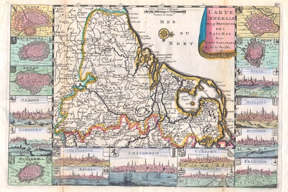
1710s maps of the netherlands
18th-century maps of belgium
old maps of dutch brazil
recife in the 1660s
eran laor cartographic collection
franz nikolaus rolffsen
maps of lyon by braun & hogenberg
1620 works in rhône
maps of goa by braun & hogenberg
maps of diu by braun & hogenberg
engravings of cities in switzerland
engravings by matthäus merian
jan karel donatus van beecq
hernán cortés
map of maastricht by willem and johannes blaeu (1649)
jekerkwartier (maastricht)
bibliothèque municipale de reims, rès. g 152
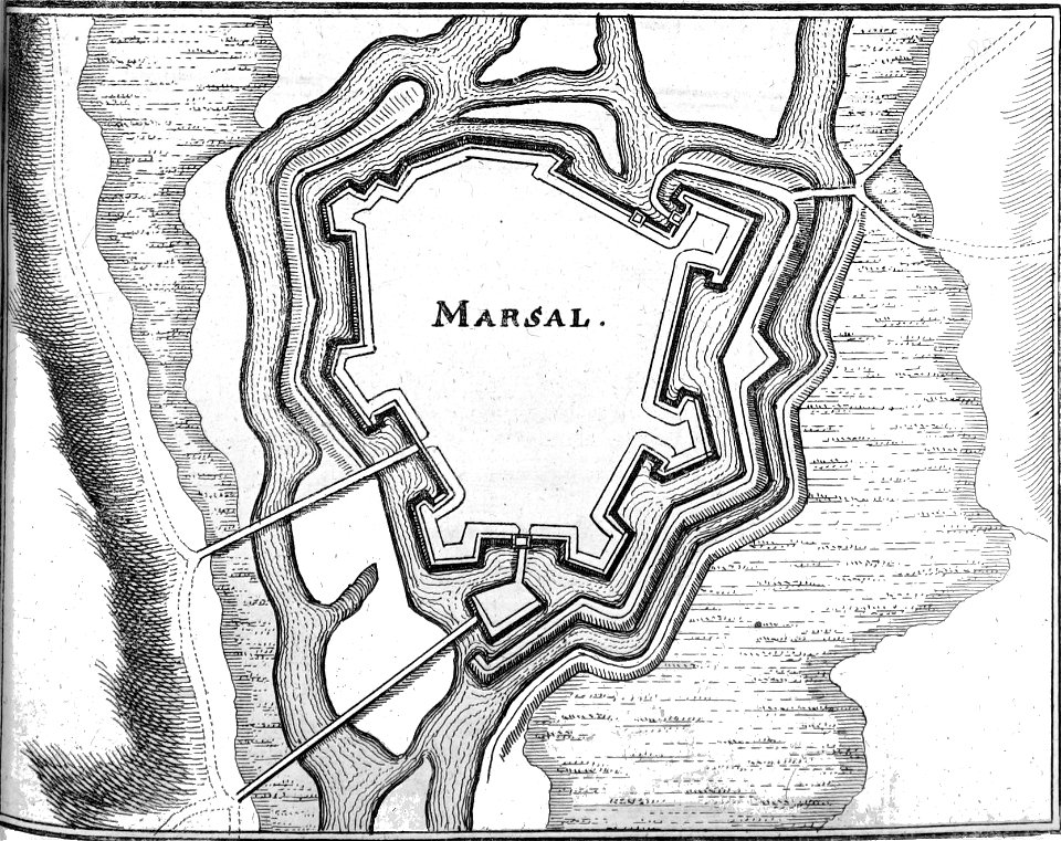
old maps of marsal
maps of bouchain city walls
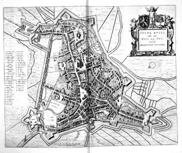
old maps of bouchain
lithographs of paris
floor plans of paris
galleria delle carte geografiche - ceiling
paintings of saint paul
maps in the library of congress
1960 maps of africa
maps in the library of congress
1880 maps
old maps of st. augustine, florida
john white (colonist and artist)
maps by willem and johannes blaeu
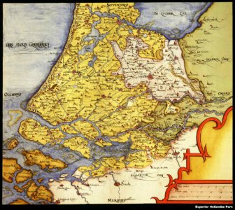
old maps of leeuwarden
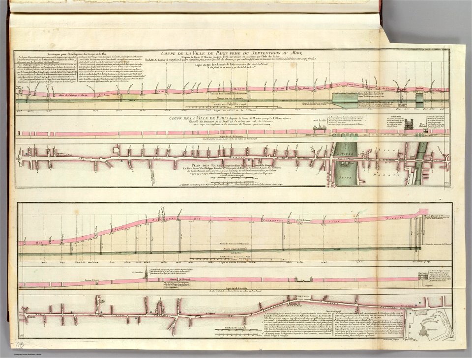
atlas des anciens plans de paris by imprimerie nationale, 1900 from the david rumsey historical map collection
maps of paris from the david rumsey historical map collection
atlas des anciens plans de paris by imprimerie nationale, 1900 from the david rumsey historical map collection
maps of paris from the david rumsey historical map collection
atlas des anciens plans de paris by imprimerie nationale, 1900 from the david rumsey historical map collection
maps of paris from the david rumsey historical map collection
atlas des anciens plans de paris by imprimerie nationale, 1900 from the david rumsey historical map collection
maps of paris from the david rumsey historical map collection
maps of cities by vincenzo coronelli
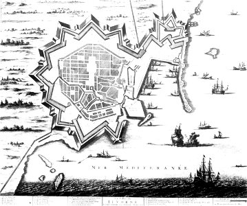
old maps of livorno
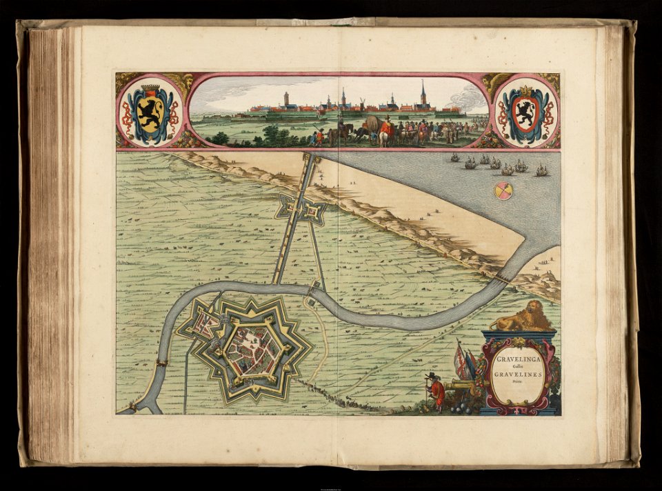
maps of gravelines city wall
old maps of gravelines
ancienne église saint-hippolyte de paris
churches on turgot map of paris
topographischer atlas der schweiz
old maps of zürich
maps of paris from the barry lawrence ruderman antique maps inc.
plan de turgot
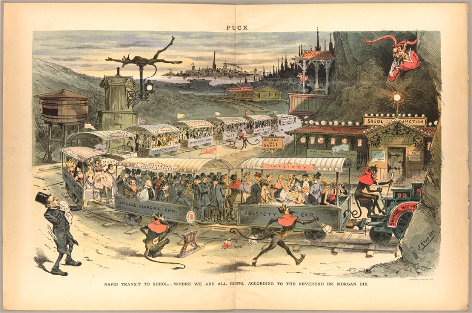
cornell: persuasive cartography: the pj mode collection
cartoons by joseph keppler
beschreibung der städt der welt - braun & hogenberg - btv1b52512111k
maps of trier by braun & hogenberg
18th-century maps of new orleans
maps in the library of congress
maps of cities in venezuela
maps by juan lopez
maps of paris from paris musées
baroque
emmerich am rhein in art
atlas beudeker
maps of america by guillaume delisle (18th century)
1760s maps of the americas
maps of erfurt by braun & hogenberg
maps of jena by braun & hogenberg
maps of gouda by braun & hogenberg
city gates in gouda
media from accademia delle scienze di torino
1574 illustrations
maps by matthäus merian
baroque
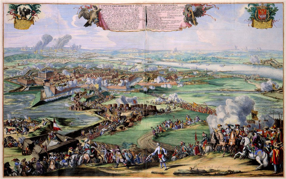
17th-century fortress plans
atlas van loon
matthäus merians vogelschauplan von frankfurt am main (1628)
baroque
map of maastricht by willem and johannes blaeu (1649)
first medieval city wall of maastricht
maps in the staats- und universitätsbibliothek hamburg
maps of hamburg-altstadt
coats of arms of mézières (ardennes)
victor levasseur - maps of france
map of amsterdam, 1544
stadsarchief amsterdam
hamburg in topographia saxoniae inferioris (merian)
baroque
eran laor cartographic collection
jaspar isaac
historical images of île de la barthelasse
villeneuve-lès-avignon
coat of arms of gregorius xiii (galleria delle carte geografiche)
reliefs of coats of arms in rome
old maps of zürich
heinrich keller
topographia westphaliae (merian)
baroque
collections of the kobe city museum
18th-century maps of africa
maps in the rijksmuseum amsterdam
maps of paris by frans hogenberg
maps of duisburg by braun & hogenberg
maps of emmerich by braun & hogenberg
maps by tomas lopez
1785 maps of africa
maps by christian sgrothen
old maps of utrecht
maps in the library of congress
1852 maps
john rocque 1746 crops from library of congress
john rocque
atlas van der hagen (volume 1)
atlas van der hagen
coats of arms of cities in manche
19th-century maps of manche
coats of arms of cities in pyrénées-atlantiques
old maps of pyrénées-atlantiques
maps by pieter mortier
old maps of genoa
maps in the library of congress
market square (knoxville)
merian mainz trier köln
baroque
sanborn maps of manhattan published in 1904
wanamaker's (manhattan)
19th-century maps of antwerp
maps of antwerp city walls
old maps of milan
antoine aveline
asia noviter delineata
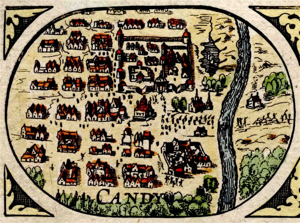
history of kandy
1780s maps of berlin
1786 maps of berlin
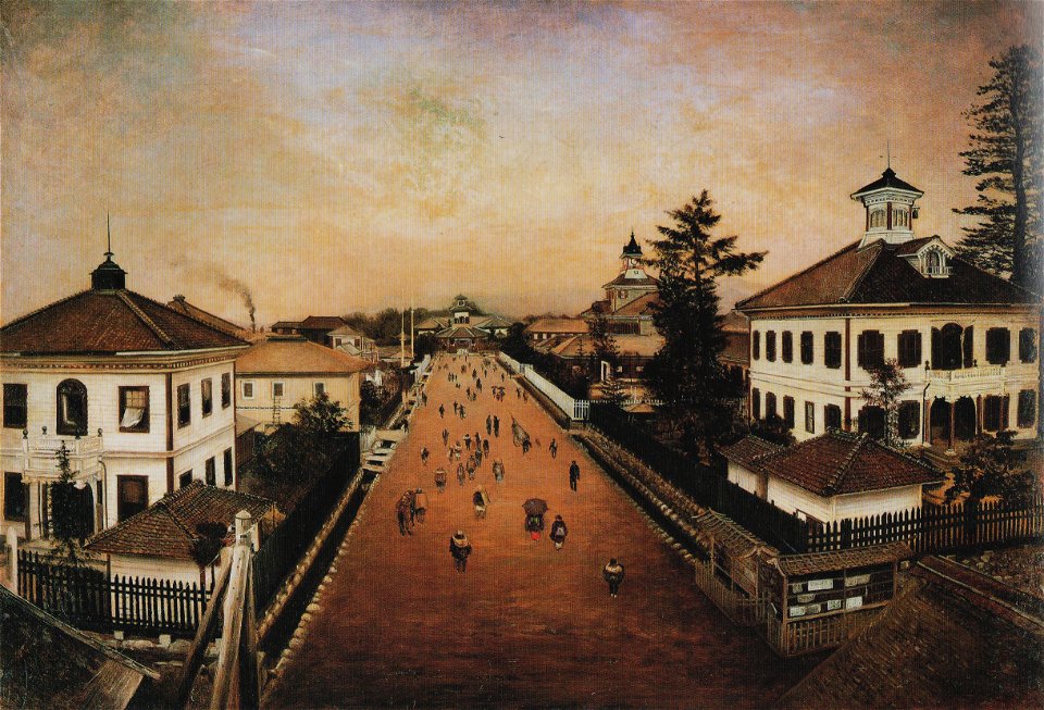
paintings by takahashi yuichi
yōga
map of bruges by marcus gheeraerts (i)
old maps of sluis
victor levasseur - maps of the world
old maps of north america
maps from university of amsterdam special collections
atlas der neederlanden
maps of frankfurt-innenstadt
maps of frankfurt-nordend
map of maastricht by willem and johannes blaeu (1649)
first medieval city wall of maastricht
old maps of the new kingdom of granada
maps by willem and johannes blaeu
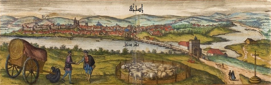
maps of écija by braun & hogenberg
andalusia in the 1570s
17th-century maps of amsterdam
maps by nicolaes visscher i
senefelderstraße 45 (stuttgart)
theodor von landauer
brooklyn bridge – city hall (irt lexington avenue line)
the street railway journal (1904)
city gates in gouda
old maps of gouda
maps from university of amsterdam special collections
atlas der neederlanden
beschreibung der städt der welt - braun & hogenberg - btv1b52512111k
dresden in the 1580s
civitates orbis terrarum. urbium praecipuarum totius mundi. liber quartus
maps of malmö by braun & hogenberg
civitates orbis terrarum. urbium praecipuarum totius mundi. liber quartus
maps of lund by braun & hogenberg
eran laor cartographic collection
baroque
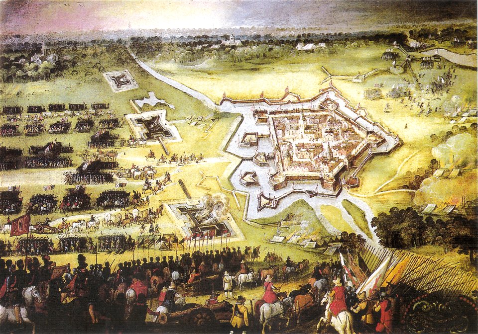
paintings of battles by peter snayers
cityscapes in art
ancien couvent des dominicains (avignon)
cosmographia (1575) by sebastian münster
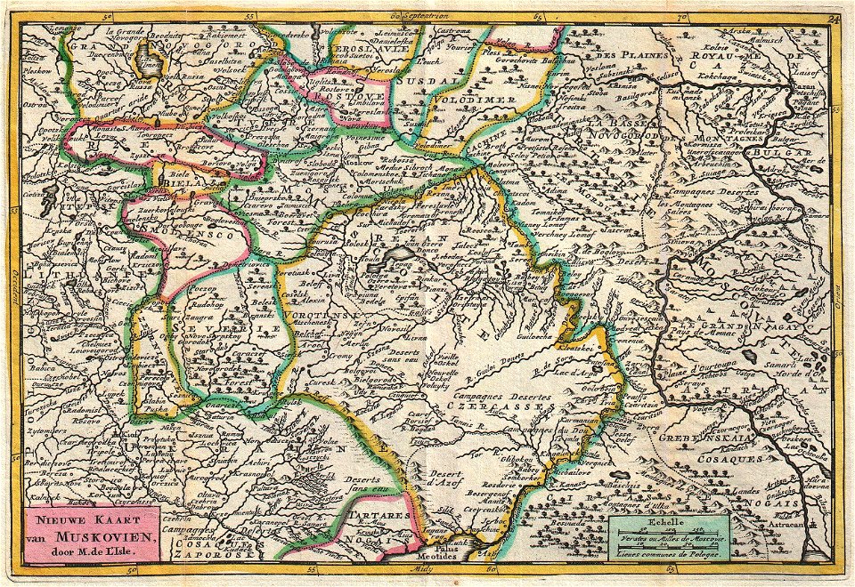
old maps of the russian empire
daniel de la feuille
lechenich
baroque
flandria illustrata
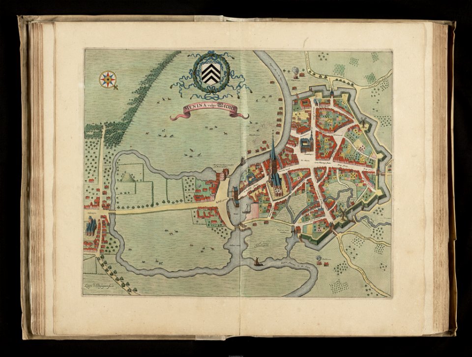
old maps of menen
maps of emden by braun & hogenberg
große kirche (emden)
civitates orbis terrarum. contrafactur und beschreibung von den vornembsten stetten der welt. liber tertius
maps of philippeville by braun & hogenberg
civitates orbis terrarum. contrafactur und beschreibung von den vornembsten stetten der welt. liber tertius
maps of arnhem by braun & hogenberg
civitates orbis terrarum. contrafactur und beschreibung von den vornembsten stetten der welt. liber tertius
maps of fortress of charlemont by braun & hogenberg
johann friedrich walther
1738 in berlin-mitte
1574 maps of africa
1570s maps of egypt
old maps of łódź
kosmopolita
maps of 's-hertogenbosch by braun & hogenberg
atlas beudeker
atlas schoemaker-noord-holland, amsterdam
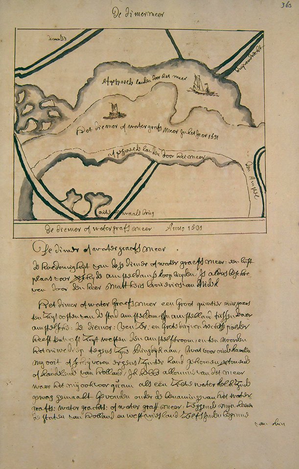
history of diemen
701 - 800 of 2,977
Next page
/ 30